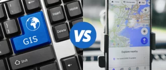
Learning about geographic information systems (GIS) as a specialization allows students to explore software tools, delve into concepts, and understand the terminology used for spatial modeling and analysis. I explored the best online GIS certificate programs to help you chose the one that works best for your circumstances. I reviewed the ones offered by continuing educational systems such as Coursera or Udemy, and the ones offered online by universities and colleges.
After reading this article, you will know how to:
- Evaluate the course content and requirements of online GIS certificate programs.
- Choose from the best GIS certificate online programs to find the one most suitable for you.
- Decide if you should get a certificate from an online continuing education system or an online university program for the potential of helping your career advancement.
I have been working with GIS applications for a long time. I enjoy expanding my knowledge of GIS by taking online courses. I improved my career advancement efforts by taking the UCLA GIS certificate course. This article reviews GIS courses from the most basic level to the most advanced master’s level.
My Top Pick
Here is the best GIS certificate online program out there:
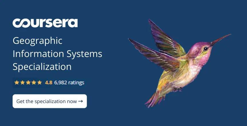
Geographic Information Systems (GIS) Specialization (Coursera) →
 Specialization (Coursera)")
What’s inside?
- Work with raster data and analyze it for a geospatial project
- Learn how to use DataViz
- Use ModelBuilder to process large workflows
- Understand cartography concepts and create maps
- Use GIS to explain or interpret practical results
Killer feature
- Learn how to use the popular ArcGIS software application
The price of this course is a bargain if completed within one year on an unlimited Coursera membership of $399. Included in the tuition is a one-year license of ArcGIS for non-commercial student use. There are five courses in this certificate program. Each course takes about four weeks. A student may complete this certificate program in about 20 weeks.
Also Great
GIS, Mapping, and Spatial Analysis Specialization (Coursera) →
")
What’s inside?
- The course is for beginners to learn about GIS mapping and spatial analysis
- There are four courses to get a certificate that can be completed in a total of 24 weeks
- Learn about ArcGis
- Fast track your career as a GIS Analyst
- Learn how to flatten the globe using map projections
Killer feature
- After completing this certificate course, you will have mastered GIS mapping skills
This certificate course is for beginners with no previous GIS experience. The focus is on learning the skills necessary to become a competent GIS mapper. Students learn how to convert the three-dimensional information of any part of the earth into a two-dimensional map. This skill is very useful for giving GIS presentations.
GIS Certificate (Michigan State University) →

What’s inside?
- This certificate has the name recognition of Michigan State University
- Learn about GIS, global positioning (GPS), and how to use remote sensing
- Create maps using free open-source software
- Provides a strong foundation in geospatial technology and its applications
- Apply GIS analytics to solve real-world problems
Killer feature
- There is a diverse selection of specialty GIS courses to take as an option to enhance your certification program
The best part of this course is the variety of specialization choices. The fundamentals of the GIS certificate are four courses in geospatial technology, GIS, remote sensing, and cartography (mapping). Then, you can add optional courses in many specializations to gain additional expertise.
Four Steps to Choose the Best GIS Certificate Online Program
Follow these steps to evaluate the online course offerings for GIS certificate programs.
Step 1. Begin With Your Goal in Mind

The type of course you will want to take depends on how you plan to benefit from having a GIS certificate. Are you studying to get your first job as a GIS specialist? Or you might be taking the course as part of continuing education requirements.
Do you want to make a career change? Are you seeking a second career as a retiree? Are you just interested in adding GIS skills to your current level of expertise? Answering these questions will help you decide which certificate course best fits your needs.
If you are already employed and want to add GIS skills as part of your career advancement strategy, ask your boss what they think of the certificate courses you are considering.
Step 2. Consider GIS Specialization Courses

GIS is a very broad field used by many industry sectors in multiple ways. For all applications of GIS, it is helpful to know the basics and have familiarity with the most popular tools and software. However, for many practical applications of GIS, there are very narrow and important specializations.
For example, GIS for law enforcement focuses on tracking and enforcement of regulations, such as might be used for animal herd monitoring to stop illegal poaching efforts.
Another application of GIS is for environmental studies. This study involves mapping skills and analysis of GIS cartography for geospatial climate changes. Still, another type of project may include survey mapping for a major infrastructure construction project.
You can also decide on your focus of study to make choosing a certificate program more related to what you want to do with GIS applications.
Many GIS certificate programs have the fundamental course requirements and then allow a student to choose a specialty for more focus on a specific application of GIS technology.
Step 3. Plan your Budget of Money and Time

Some certificate programs offer discounts for various categories, such as residents from the local area where the school is or active military or veterans.
Financing may also be available. You can spread your investment in the cost of getting a certificate over time and pay for it after you finish the certificate program. Be very careful you do not take on too much student debt that you will have difficulty repaying later.
Besides the money needed, be sure to budget the time you need to study. Learning about GIS is challenging, and you need to focus on your studies with enough attention to learn the subject matter. If you just got married and have a new baby, it may not be the best time to try to take on the added burden of getting your GIS certificate.
The good news is that anyone committed to learning GIS and getting a certificate can accomplish this task. All categories of people are welcome in this field.
| 1. Geographic Information Systems (GIS) Specialization (Coursera) →
This certificate course includes a one-year license (student version) for the popular and expensive ArcGIS software. |
Check price → |
| 2. GIS, Mapping, and Spatial Analysis Specialization (Coursera) →
This certificate course design is for those interested in specializing in GIS mapping. |
Check price → |
| 3. GIS Certification Course (Udemy) →
This GIS certification course focuses on photogrammetry, taking measurements from photos to make 3-D models of the spatial environment. |
Check price → |
| 4. An Introduction to GIS and QGIS (Udemy) →
This offering is a very low-cost ($12.99) beginner’s course suitable for those with no GIS experience who want to get an overview of GIS. Students get a certificate of course completion. |
Check price → |
| 5. Post-Baccalaureate Certificate in Geographic Information Systems (Pennsylvania State University) →
This certificate comes from a well-recognized institution. It is an expensive ($11,088) master-level certificate program from a major university. |
Check price → |
| 6. GIS and Geospatial Technology (UCLA) →
This course many take for the excellent training and the brand recognition of a certificate diploma from UCLA. |
Check price → |
| 7. GIS Certificate (Michigan State University) →
This certificate is a bargain price ($3,500) for a certificate from a major university. Students can add GIS specialization courses for $500 each to the basic certificate program. |
Check price → |
| 8. Online Geographic Information Science Undergraduate Certificate (Arizona State University) →
This certificate program is similar to getting a two-year undergraduate degree. |
Check price → |
| 9. Geographic Information Systems (NC State University) →
This certificate program is at the graduate (master’s) level. |
Check price → |
| 10. Undergrad. Certificate, GIS Use in Non-Profit Organizations (Brandman University) →
This undergraduate certification program focuses on GIS technology applications for use by non-profit, non-governmental organizations (NGOs). |
Check price → |
| 11. Geographic Information Systems (GIS) Certificate (Elmhurst College) →
The school provides the GIS software tools the student needs to complete the certificate program as a cloud-based, software-as-a-service (SaaS). |
Check price → |
| 12. Online Geographic Information Sciences Certificate (South Dakota State University) →
This certificate course does not require previous GIS experience or any college degree. |
Check price → |
| 13. Geographic Information Systems (GIS) Certificate (California State University, Fullerton) →
Dr. Underhill, who teaches this certificate course, is a female thought leader in advanced GIS systems who encourages women and others to enter this field. |
Check price → |
| 14. Geographic Information Systems (College of Western Idaho) →
This program provides a good GIS foundation and offers a 50% discount on tuition for seniors over 60 years old. |
Check price → |
| 15. Online GIS Certificate: GIS & Cartography (Ohio University) →
This Ohio university GIS certificate program is an excellent choice for those seeking brand recognition from a major university. |
Check price → |
This video is a TedX talk about GIS presented by Dan Scollon.
This TedX talk happened in 2013, so it is interesting to see a bit of historical perspective on GIS.
Online Platforms Certificate Programs
Here are the online certificate programs not affiliated with a university or college.
1. Geographic Information Systems (GIS) Specialization (Coursera) →
Price: This course may be audited for free. You must pay for enrollment if you wish to get a certificate of completion. Financial aid is available. The paid course offers a seven-day free trial, which converts to a monthly subscription of $39 to $79 per month depending on the courses taken. A full-year subscription is $399. A one-year, non-commercial, student license for ArcGIS is included.
Duration: This course is part of a five-course program for a certification in the specialization. However, you can take this course separately. Students complete this single course in four weeks.
Having skills in Geographic Information Systems (GIS) allows you to pursue a career in agriculture, public health, and many other industries that operate globally. This course teaches how to analyze spatial data and use some techniques of cartography to communicate results via maps. Understanding GIS allows collaboration with peers working on a GIS-dependent project.
What certificate you will get: Upon completion of the course and submitting the hands-on project, you will get a certificate in Geographic Information Systems (GIS)
You will learn:
- How to work and create with raster data.
- How to use ModelBuilder to handle a large processing-workflow.
- How to develop data and analyze it for a geospatial project.
- How to create a hypothesis or question using GIS.
- How to explain and interpret practical results compared to the GIS hypothesis.
- How to use Data Visualization (DataViz).
- How to work with satellite imagery to conduct imagery analysis.
Learner feedback:
“If you want to learn ArcGIS this is a great course for a beginner or for those who wish to brush up on their skills. The professor gave lessons that were clear and easy to understand. I was able to keep up with the pace of the course and it was interesting and challenging. I appreciate being able to access courses through Coursera from top-notch professors even though I live in a small village halfway around the world.”
Best for: Beginners, who are learning ArcGIS, and those who have little experience with GIS. This course is good for architects, engineers, sociologists, surveyors, planners, miners, scientists, and many others who use GIS as a tool for their projects and work.
2. GIS, Mapping, and Spatial Analysis Specialization (Coursera) →
Price: Free auditing of this course is permitted. To get a certificate of completion, you must pay for the course. The paid course has a seven-day free trial. A monthly subscription for Coursera is $39 to $79 per month depending on the classes you take. A full-year subscription costs $399. Financial aid is available.
Duration: This course is part of a four-course program to gain a certification in GIS mapping. Each course takes six weeks to complete (a total of 14 hours.).
This is a beginner’s course to learn about GIS, mapping, and spatial analysis for those interested in learning how real things in the world are represented in maps. After you take this course, you can create a 2-D map from the information describing three-dimensional earth.
What certificate you will get: If you complete all four courses including the project assignment you will get a certificate in GIS mapping.
You will learn:
- What is GIS?
- What terminology is used for GIS.
- How to get started with ArcGIS software (software is not included).
- How to describe locations using their coordinates.
- How to map anywhere in the world using vector and raster data.
- How to flatten the globe with map projections.
- What it means to be a GIS analyst.
- How to create GIS data from a location of your choice.
Learner feedback:
“I used ARCMap before so I had some slight experience with GIS. I enjoyed learning about ArcGIS because the software is popular. For me, this first course in the series of four to get a certificate was very interesting. I especially liked the parts about coordinate systems and how to make map projections. This was a source of confusion for me before. Now, I really understand how all that works together. I plan to take the other three courses. Excellent course, highly recommended.”
Best for: People just getting started with GIS who need a comprehensive introductory course and want some hands-on experience creating a map.
3. GIS Certification Course: Geographic Information Systems (Udemy) →
")
Price: $13.99
Duration: Seven hours of on-demand video.
The course teaches Photogrammetry, which is used to make a 3-D model by taking measurements from photos and analyzing certain points on an object. The data generated from applying Photogrammetry is used along with GIS to solve problems and manage information about exact locations.
What certificate you will get: Students who finish the course will get a Certificate of Completion.
You will learn:
- The basics about GIS.
- How to elaborate different kinds of GIS maps.
- The general applications of Photogrammetry.
- How to use Photogrammetry with aerial photographs.
- How to complete a project using Photogrammetry.
- How to interpret aerial photographs and identify features.
- How to explain an engineering drawing with a 3-D perspective.
Learner feedback:
“This course starts without assuming you know anything about mapping or GIS. Much of the instructions are how to do basic things. This is meant to be an easy course to get a taste of how to use GIS to make maps, so it does not go into much detail about how to use the advanced features of the GIS software tools. For me, it was a bit too basic, but as an entry-level course for GIS certification, it makes sense to start at the beginning.”
Best for: geography students and students studying engineering, land surveying, aerial photography, and map mapping. Professionals, in related sectors, benefit from obtaining GIS certification and can study GIS as continuing education.
4. An Introduction to GIS and QGIS (Udemy) →
")
Price: $12.99
Duration: This course contains one and one-half hours of on-demand video. It takes only about two hours to complete; however many students like to continue to use the software for longer to become more familiar with it.
This introductory course covers GIS and QGIS at the beginner’s level. No previous experience with GIS is necessary prior to taking this course. It covers the fundamentals and offers a practical experience using sample data with QGIS.
What certificate you will get: Students who finish this course will get a Certificate of Completion.
You will learn:
- To understand the principles that are fundamental for GIS.
- To be familiar with GIS terminology.
- How to use GIS software at the beginner’s level.
- How to use the functional basics of QGIS.
Learner feedback:
“This course was a nice brief introduction to the QGIS interface with some use of ArcGIS. The map visualization was nice. The course was just what I was looking for because assumed I knew nothing and even explained basic functions like right-clicking, so even someone new to computers would not get lost. As an introductory course, it is very good. It was easy to understand and the lectures were engaging.”
Best for: Students who have little or no prior experience with GIS. This is a basic course not suitable for advanced GIS students. It would be helpful to take this course for those switching from a different GIS software program to QGIS because it is a nice introduction to how QGIS works.
The Universities and Colleges Online Certificate Programs
The online certificate programs affiliated with a university or college may add prestige to the certificate.
5. Post-Baccalaureate Certificate in Geographic Information Systems (Pennsylvania State University) →

Price: $924 per credit. The certificate requires 12 credits for a total of $11,088.
Duration: This program has four courses of three credits each. Each instructor-led course is for ten weeks. Each course requires 10 to 12 hours of studying per week. It is possible for a full-time student to finish the program within one year.
Study geospatial topics and work with up-to-date software to gain direct experiences with GIS mapping. If you are already a professional with some GIS experience, you are allowed to bypass the introductory courses and choose elective courses from more advanced levels.
What certificate you will get: Take this program for certification by PennState in GIS. This is a stand-alone certificate that also serves as the entry requirement for the PennState Masters program in GIS.
You will learn:
- The scope, impact, and projections for the geospatial industry.
- How GIS facilitates data collection, data analysis, and communication efforts when working with common geographic problems.
- GIS database development.
- How to design a GIS database.
- How to maintain a GIS database.
- Data integration using desktop GIS software.
- Elective courses in this program include cyber-geography, remote-sensed imagery, understanding lidar systems, and many more.
Learner feedback:
“My experience taking this program and getting a certificate from PennState was that the skills I learned are in high-demand. I was able to use what I learned and the qualification certificate to get a job working for the government in Thailand to help map the areas with the most refugees to understand the root causes of their displacement.”
Best for: Beginners or experts working in the industry sectors of facilities management, environmental resources, urban planning, regional planning, local government, transportation planning, or another related field. Applicants for this program must have a BA from an accredited educational institution.
6. GIS and Geospatial Technology (UCLA) →
")
Price: $8,475 (estimated total) – $200 (application fee), $7,875 tuition, and $400 for textbooks.
Duration: This certification program requires completing five courses. There is about 150 hours of course instruction plus students spend an additional 10 hours per course per week. Full-time students can complete this certificate program within one year.
The required courses in this program are Introduction to Geographic Information Systems (GIS), GIS Databases and Enterprise GIS, Cartography, Intermediate Geographic Information Systems (GIS), and Advanced Geographic Information System. This program introduces GIS and geospatial mapping using GIS software.
What certificate you will get: Students who finish the program get a GIS certificate.
You will learn:
- How to create maps using GIS open-source software.
- How to analyze GIS data.
- How to work with the popular software including ArcGIS, Esri, and QGIS.
- How to think spatially and communicate with cartography.
- The design and usage of geospatial databases.
- How to work with multi-user geo-databases.
- How to conduct advanced spatial analysis and use data visualization tools to solve global problems.
Learner feedback:
“I had no knowledge of GIS when I started this program. After a year, and completing the program, I have excellent GIS skills, feel very confident, and have plenty of job opportunities to choose from, where having a GIS certificate looks impressive on my resume.”
Best for: Students entering the fields of GIS technology who want to acquire highly-marketable GIS skills. Professionals working with geospatial technology and those who want to learn more about working with maps and conducting spatial analysis.
A GIS developer is a much more advanced position than a basic GIS analyst. GIS developers write the software code for the various GIS tools. In America, the pay starts at about $58,000 per year and goes up to $138,000 for a senior developer. Learn more about becoming a GIS developer here.
7. GIS Certificate (Michigan State University) →
Price: Core courses cost $875 each. Specialization courses cost $500 each. There is a $200 discount for completing all four courses, so the total cost for just the certificate program is $3,500.
Duration: There are many seven week courses to take individually or combined to earn a professional GIS certificate.
The GIS Certificate requires successfully finishing four courses, which are Introduction to Geospatial Technology, Geographic Information Systems (GIS), Remote Sensing, and Cartography.
What certificate you will get: Students who finish the four courses get the Professional GIS Certificate.
You will learn:
- Tools and technologies geospatial professionals use to work with geographic information.
- About geographic information systems (GIS), global positioning systems (GPS), and remote sensing.
- To create maps using free open-source mapping programs.
- How to gain proficiency using the popular GIS software called ArcGIS.
- How to apply GIS analysis to solve global problems.
- The technical skills needed for interpreting aerial images.
- Cartographic map design, including graphic design, fonts, and using visual cues
Learner feedback:
“I increased my knowledge with new skills that have practical use in my future plans to work with GIS and geospatial projects. My experience with this online program was excellent. I feel like I have an advantage over others in my field that do not have GIS certification, as my GIS skills are highly marketable. I plan to continue using ArcGIS until I am an expert.”
Best for: Students wanting to work in GIS and professionals wanting to improve their careers with knowledge and certification in geospatial technologies. These courses provide continuing education and training for teachers. International students benefit from having certification from an American university.
If you are looking for a job based on your GIS skills, you will want to read about how to create a GIS portfolio here. The article discussed eight key points about creating a GIS portfolio and gives five examples that you can use to help create a portfolio of your work to show to prospective employers.
8. Online Geographic Information Science Undergraduate Certificate (Arizona State University) →
")
Price: The price for this program is $530 per credit hour. There are 20 total credit hours needed to complete this program.
Duration: This program has six classes. There are seven and one-half weeks per class.
Studying for this GIS certificate teaches you the skills needed to utilize geospatial technology to create a visual model from geographic information and spatial data. The GIS certificate works well for those seeking degrees or working in geography, urban planning, life sciences, anthropology, and other specialties that use geospatial technology.
What certificate you will get: Students who finish the six courses get an Undergraduate GIS Certificate.
You will learn:
- Cross-disciplinary applications of geographic information systems.
- How to interpret geographic data.
- How to create visual representations of the geographic information.
- The terminology used for GIS.
- Opportunities for specialization.
- How to program the GIS databases.
- Cartography and aerial photo interpretations.
Learner feedback:
“Attending ASU course online allowed me to gain college credit at a much lower cost than in-person attendance. I have always been a fan of continuing education. I have a full-time job as an engineer and I wanted to get my GIS certificate so I can do more government contract work that requires knowledge of geospatial tools like ArcGIS.”
Best for: Students who are pursuing related degrees. Professionals who want to expand their competence levels with ongoing education and certification. Those who have an interest in mapmaking as a marketable skill.
9. Geographic Information Systems (NC State University) →
")
Price: The cost to take courses for this program is $462 per credit hour for North Carolina residents and $1,311 per credit hour for non-residents. The total cost is $5,544 for North Carolina residents and $15,732 for non-residents.
Duration: The certificate requires four graduate courses. The time to complete the certification program is one year as a full-time student and up to two and one-half years as a part-time student.
The Graduate Certificate in Geographic Information Systems provides students with a graduate school level credential. This degree program is for serious students of Geographic Information Systems (GIS) and their applications.
What certificate you will get: Students who successfully complete this program receive a Graduate Certificate in Geographic Information Systems.
You will learn:
- How geographic information systems are used for communication and data analysis to solve geographic problems.
- How to develop expertise in geographic data modeling.
- How to use desktop GIS software and cloud-based solutions.
- Spatial problem solving.
- How to use GIS data analysis to guide decision making.
- How to integrate and analyze geospatial data in different formats.
- How to find opportunities for geospatial data analysis.
Learner feedback:
“I relocated to North Carolina so I could work there and then I found this online program. I brought up the idea to my boss of taking the online courses to get a certification and my boss fully supported the idea. I was not in a rush so I enjoyed taking one course at a time and completed the program over two years while working full-time and studying at home at night.”
Best for: Students who are seeking master-level certification in GIS technology and professionals who are wishing to enhance their careers or make a career change.
Using thematic maps as overlays on a reference map is an excellent way to make a presentation that explores a real-world problem, such as global warming, wildfire proliferation, desertification, or population migration. You can read more about this specialization here.
10. Undergraduate Certificate, GIS Use in Non-Profit Organizations (Brandman University) →
")
Price: $250 per unit. Courses are three units. The total cost for this course is $750.
Duration: This is a single course and is taken online and completed during a single semester.
The undergraduate Certificate in Nonprofit GIS trains students using the GIS tools for geospatial strategies. It improves a student’s geospatial thinking. Using GIS gives non-profits and non-governmental organizations (NGOs) more ways to analyze Big Data that affects their stakeholders.
What certificate you will get: Students who finish this course program will get an Undergraduate Certificate in Nonprofit GIS.
You will learn:
- About geospatial theory in relation to society.
- How to build a data-driven report.
- How to collect geospatial data for your presentation.
- How to improve your presentation skills using GIS information.
- How to create maps with cartography tools.
- How to interpret aerial photography to use GIS information in NGO efforts.
- How to map refugee flows.
Learner feedback:
“I took this course because the following year I was scheduled to volunteer to help a medicine delivery program in Africa that delivers emergency medicine by using remote-controlled flying drones. Learning about GIS was a valuable thing to do for helping out with my volunteer efforts.”
Best for: Professionals and those who volunteer to help non-profit organizations in diverse fields such as advocacy, direct social services agencies, education, and healthcare.
11. Geographic Information Systems (GIS) Certificate (Elmhurst College) →

Price: $810 per semester hour. A total of $16,200 to complete the certificate program.
Duration: To get a certificate, a student must complete five courses for five credits (20 semester hours). Courses are accelerated, which allow this certificate program to be completed in less than one year.
This GIS certificate course program is entirely online. There is no need to visit the campus or to download software. The school provides state-of-the-art GIS software tools on a cloud server that is easily accessible from anywhere with a decent Internet connection.
What certificate you will get: Students who complete the course get a Geographic Information Systems (GIS) certificate.
You will learn:
- How to collect GIS data.
- How to analyze GIS data.
- How to create maps.
- How to solve spatial problems.
Learner feedback:
“I love this program. It was interesting and fun to learn about GIS. I am confident that having this certificate will help me with my job and perhaps help me find a better one.”
Best for: Adult students and professionals who want to expand their marketable skills by learning about GIS, which has applications in many industries such as emergency management, crime analysis, and national security.
12. Online Geographic Information Sciences Certificate (South Dakota State University) →
![]()
Price: This is a 12-credit hour certificate program. The price for undergraduates is $354.75 per credit hour ($4,257.00 for the course). For active-duty military and national guard, $250.00 per credit hour ($3,000.00 for the course). For state employees, $225.20 per credit hour ($2,702.40 for the course). For qualified veterans, $95.65 per credit hour ($1,147.80 for the course).
Duration: This program requires taking four courses of three credits each. The program takes three semesters to complete, or the student can take the course at their own pace.
The Geographic Information Sciences online certificate program is a 12-credit course that teaches students how to use geospatial tools to present geographical concepts. Elective course choices allow a student to specialize in either GIS or Remote Sensing/Cartography. The program design gives students a deeper understanding of GIS without requiring the student to have a bachelor’s degree.
What certificate you will get: Geographic Information Sciences Certificate.
You will learn:
- How to collect GIS information about places, people, and the spatial environment.
- How to research, synthesize, organize, and analyze GIS information to create governmental reports and for other applications.
- Cartography or remote sensing using aerial methods.
- Vector/raster modeling methods.
- Quantitative analysis of remote sensing data.
- How to communicate geographical concepts using maps in presentations.
- How to create flowcharts, graphs, tables, and graphics.
Learner feedback:
“I was amazed at how comprehensive this course was and what a wonderful overview of the GIS it contained. Since I am a new student of GIS, I was grateful that no previous experience with GIS was required, and there was not a BA or BS degree prerequisite to take this course.”
Best for: Students who plan to work for governmental agencies on any level who need GIS skills for their work, including agencies involved with the US Geological Survey.
13. Geographic Information Systems (GIS) Certificate (California State University, Fullerton) →
 Certificate (California State University, Fullerton)")
Price: $3,210.
Duration: 8 months.
This program is taught by Dr. Underhill, who is a leading scholar in GIS systems. This course allows a student to get a GIS certificate in eight months. The course content integrates geography, GIS data, and GIS systems. Students learn to solve various challenging problems for government agencies and businesses in law enforcement, healthcare, insurance, and other specialties.
What certificate you will get: Geographic Information Sciences Certificate.
You will learn:
- To understand fundamental concepts of GIS including its historical development and innovative progress.
- How to be able to work with the GIS hardware, software applications, and data collection systems.
- How to become a GIS specialist working for government agencies or companies.
- To understand how to work with GIS databases, data sources, and data types.
- How to work with ArcGIS and other GIS applications.
- How to complete a GIS project with the skills learned from taking this program.
Learner feedback:
“I was excited to take this course when I read that the median pay for a GIS Specialist is over $68,000 annually. The pandemic forced my career change when the company I worked for went out of business. I decided to take this course to get a better job.”
Best for: Recent BA graduates, employees of companies and agencies using GIS, professionals seeking a career change, and retirees seeking a second career.
14. Geographic Information Systems (College of Western Idaho) →
")
Price: The price for in-district Idaho residents is $139 per credit ($2,502 for the certificate program), for out-of-district Idaho residents the price is $189 per credit ($3,402 for the certificate program), for out-of-state and international students the price is $306 per credit ($5,508 for the certificate program). Seniors over the age of 60 get a 50% discount for each of these categories.
Duration: Three semesters or at the student’s own pace.
The Geographic Information Systems Academic Certificate program is a comprehensive curriculum that prepares a student for an entry-level GIS specialist position. The certificate program teaches GIS theory and gives a student hands-on experience using GIS software and geospatial technology.
What certificate you will get: Geographic Information Systems Academic Certificate.
You will learn:
- How to analyze a real-world problem or challenge using GIS skills and GIS applications.
- How to use the current innovative solutions offered by popular GIS software.
- How to create programming code in the Python language that provides GIS automation.
- How to create maps using GIS.
- How to solve spatial problems.
- How to answer geospatial questions using critical thinking.
- How to make a presentation using GIS mapping.
Learner feedback:
“This is a terrific program. I was able to get a 50% discount because I am over 60 years old, which made this certificate program an absolute bargain.”
Best for: Students with this certificate may find jobs in government agencies, engineering businesses, organizations working on environmental issues, natural resource exploration, mining, utilities, and many other sectors that utilize GIS systems.
15. Online GIS Certificate: GIS & Cartography (Ohio University) →
![]()
Price: Ohio residents pay $512 per credit hour ($6,144 for the 12-credit-hour certificate course). Non-residents pay $531 per credit hour ($6,372 for the certificate course).
Duration: Three courses of four credit hours. A student completes the program in three semesters or at the student’s pace.
Students learn how to think in spatial terms and create GIS maps. The course content includes how to use GIS to solve real-world problems. This online course design is for college students who graduated recently and do not have any prior experience with GIS systems or cartography.
What certificate you will get: GIS Certificate in GIS & Cartography
You will learn:
- GIS proficiency that is accepted by many industry sectors and governmental agencies.
- How professionals can use GIS expertise to advance their careers or apply for a new job.
- How to leverage skills in GIS-based mapping and geospatial analysis to get better pay.
- How to create widely-used GIS mapping and how to conduct thorough geospatial analysis tasks.
- How to achieve the ability to think spatially, interpret GIS maps, and use GSI to solve problems.
- How GIS mapping supports many fundamental decisions made in many industry sectors.
- How to demonstrate high-quality map design and graphical presentation abilities.
Learner feedback:
“I need to make a lateral career change to increase my salary, and this certification program was exactly what I needed to qualify for a better-paying position.”
Best for: College graduates and professionals who desire to add certified, master-level GIS skills to their resume.
This video by Dr. Chris Geoscience makes learning about GIS seem very cool.
The presenter thinks GIS is awesome but gives five things he wished he knew before learning about GIS.
Conclusion
If you are like me, once you get started learning about GIS, you will be hooked and want to learn more. It is possible to take a low-cost introductory course to learn some of the basics. If you want to use your GIS skills in your job or to get a high-salary job, it pays to complete a certificate program from a major school that is a recognized leader. Whatever you decide, it is fun to have at least a working knowledge of GIS. I hope I have encouraged you to explore GIS.