As someone who enjoys maps and navigation systems, I came across two highly used systems called the Geographic Information System (GIS) and the Global Positioning System (GPS). My goal was to find out the unique differences of these two systems and share my findings with others to help them understand the distinctions.
GPS vs. GIS- now you know. pic.twitter.com/mJdZOE7Jrk
— the_real_ms_gann (@the_gann) August 28, 2019
I conducted a lot of research and read several forums to ensure that I have the correct facts before writing my article. Now, I will go over the detailed differences of GIS vs GPS.
After reading this article, you will officially know:
- What GPS means →
- Who created the GPS device →
- How a GPS works →
- The types of GPS technology →
- What GIS means →
- How a GIS system works →
- The uses of GIS →
- The differences between GIS and GPS →
- What both GPS and GIS use →
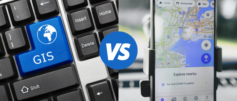
The Key Difference Between GPS and GIS
The main differences that you should remember is that the GPS system uses satellites to orbit the Earth and send information to users on the ground as well as detect their location, whereas GIS is a software program that is known for assisting individuals in using the GPS information.
What Does GPS Mean?
GPS stands for Global Positioning System. This type of system is owned by the United States and is known for providing people with locations, navigation help, and timing assistance. It is made up of three different components which are the user component, space component, and the control component. The United States Space Force is responsible for creating, developing, maintaining, and running the space and control components of the system.
Throughout the years, these devices have become increasingly popular and have made it where a lot of people do not leave home without their digital map telling them where to go. This civilian service is available for free around the world, and it is continuously being updated and improved for the modern world and future.
A great video to consider watching that explains more about why the United States Military made these systems free to use is Real Engineering’s YouTube video. This is a short video that is filled with a ton of knowledge about this system and how it came about.
Next, I will discuss who created this remarkable system.
Who Created GPS?
There are several people who took part in creating this type of system. However, one person is the main reason that this beneficial technology exists, and her name is Gladys West. A computer programmer in Virginia, Gladys West would create very large computer systems as well as a variety of data-processing systems.
These systems that she would work on were for the analysis of data that were captured from satellites. Over four decades ago, West programmed the computer that was used to calculate the planet’s geoid to the correct precisions, and this is what led to the creation of the GPS system.
Chris Krause bringing that knowledge: GPS vs GIS https://t.co/ZAE6CS9ag2
— SC Geographic Alliance (@SCGeography) November 18, 2020
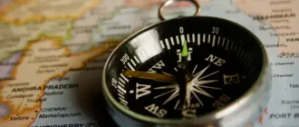
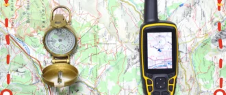
Before this system was developed, compasses were instruments commonly used to find your way around. I have also written an article on compasses and why they point north. To find out the answer to this frequently asked question, read this article.
How Does GPS Work?
If you are wondering how exactly this system works, a satellite orbits the Earth twice per day. The satellites transmit signals and parameters that send to GPS devices.
This information is translated into points and locations, which can be used to determine a user’s exact location and where they need to go. The way that it does this is by measuring the distance to each satellite by the time it takes to receive the signal.
For more information on how these devices work today, take a look at BRIGHT SIDE’s YouTube video. This video explains how determining your location and how to get somewhere has evolved over time as well as how technology stepped in to make this an easier experience. I believe that you will find this 10-minute video very interesting and worth your time to watch.
Let’s move on to learning about the different systems around the world.
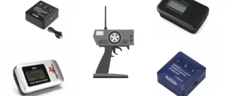
Types of GPS Technology Systems Around the Globe
There are four different Global Navigation Satellite Systems (GNSS). These four systems are called the GPS, GLONASS, Galileo, and BeiDou. The GPS system is found in the United States, and the GLONASS system is found in Russia. Galileo helps people navigate Europe, and BeiDou is the navigation system for China. There are also three regional systems which include QZSS in Japan and IRNSS or NavIC in India.
Two year ago vs. today. High-accuracy #GNSS is rocking and rolling. And, more #Galileo and #BeiDou sats launching this year. #GPS #Glonass #GIS pic.twitter.com/3IxsqNufK9
— Eric Gakstatter (@GPSGIS_Eric) March 14, 2019
These digital systems have become handy tools for work, travel, and play. A lot of people have started participating in geocaching, which is a fun game involving these types of systems. If you would like to learn more information about this game as well as find the best gps for geocaching, check out my other article here.
What Is GIS?
GIS is a special software system that develops, analyzes, manages, and lays out all types of data and information. It stands for Geographic Information System. This type of system brings specific data and information to a map, which in return integrates location points with descriptions.
The goal of this software system is to determine where things are and what everything looks like in specific locations. By doing this, maps will have more detailed and accurate information about what is around and how things look. It is setting up a foundation for mapping that is used in science, all industries, traveling, and even everyday life.
There are 10 terms that you should know when it comes to this technology. Katie Scheurer has created a YouTube video elaborating on these 10 terms. My advice is to watch this video if you have an interest in working in the field or are simply just curious to know more about this system.
Now, I will tell you how this technology works.
How Does GIS Work?
This system works by collecting, storing, and analyzing data and information to create maps that are convenient and easy to comprehend. The system may be complicated behind the scenes, but the final product is an easy-to-read map, table, or graph. When individuals look at the information created by GIS, they are able to make better decisions overall.
To learn more about this system and how it came about, check out oregonforests’ YouTube video. Christine Maynard, an expert in the field, goes over how data collected from the ground became informational maps. This is a quick two-minute video that is very informative when it comes to this type of system.
After watching that video, I will explain the uses of this software system.
Uses of GIS
While there are a variety of different uses of GIS, the most common uses are management of resources, mapping out crime areas, creating and evaluating specific routes, overseeing networks, monitoring vehicles, managing homes and business properties, preparing for wildfires, determining what a community needs, and so much more.
If you find yourself to be very interested in this field, I recommend expanding your knowledge by earning a GIS certificate. I have written an article explaining in detail each certificate program that I think will benefit people’s career and passions. For more information about these certificate programs, head over to my other article by clicking here.
GIS vs GPS in Detail
To explain in detail GIS vs GPS, you should know that GIS is used to collect and combine data and information, while GPS is used to help you find direction. It is easy to get these two systems confused and think they operate and do the same things. However, that is not the case. Below, I will tell you what these two unique systems are used for, so that you can see it in a more detailed way.
GPS is used to:
- Find locations
This is the most common reason why people use these systems. Whether an individual is traveling to a place that they have never been before or need to know the quickest route to avoid traffic, this type of system is sure to do the trick. - Prevent car theft
Cars are equipped with these devices to ensure that they can never be stolen. If a person is unsure of where their car may be or thinking it may have been stolen, authorities can track it within minutes. - Provide access to roadside support
When someone is stranded on the side of the road somewhere and needs help, this system will help emergency responders find you quickly. Majority of smartphones come with this system already installed for this reason. - Conduct Surveying and mapping
This technology is beneficial to surveying and mapping land quickly. In fact, it can cover a large around within a few minutes digitally.
GIS is used to:
- Map data
GIS can create a map of data and information quickly. This helps people look at maps and make sound decisions about communities. - Analyze proximity
This technology is able to show the proximity between two locations on a map. Therefore, individuals will be able to determine how long it will take to get to the new location from their current location. - Analyze locations and what should go in certain areas
This is important because experts need to analyze maps and information to determine what that specific community needs. For example, the individual may need to decide where to put a new hospital, library, or mall.
In simple terms, the differences between these two systems are that a GPS system is a satellite system that is used to determine one’s exact location on the Earth’s surface, and GIS is used to map out information and data from specific areas. They have similar yet very different functions.
What Do Both GPS and GIS Use?
Both of these systems use location-based services (LBS) applications. This means that they both are known for using location data and information to provide a specific service to the public. As a matter of fact, these systems go hand in hand because most GPS devices use GIS technology.
My Overall Thoughts
When it comes to the increasing demands and needs of our ever-growing technological world, GPS and GIS systems are essential elements in people’s everyday lives. Although these two systems are often overlooked and not thought about much during use, it is important to determine what exactly they do and the impact that they have.
Therefore, I hope this article helped you gain insight and understanding of GIS vs GPS. These systems interact every single day to bring us functions that are crucial to our personal and professional obligations, so we should take the time to understand how they are ultimately different and what makes this technology widely available to us.